Browse Items(64 total)

  • Tags: Landmarks
http://history.santacruzpl.org/omeka/uploads/0000/0607.jpg
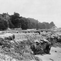
West Cliff Drive, looking east towards Lighthouse Point. The entrance gate to the lighthouse is in the background to the right. To the far right, above the trees, is the lighthouse light.

Date: ca. 1930s
Type: PHOTO

http://history.santacruzpl.org/omeka/uploads/0000/0596.jpg
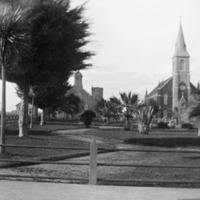
Looking across Mission Plaza at Holy Cross Roman Catholic Church. The Church sits on the site of the Mission chapel and graveyard. It was designed by Thomas J. Welsh and was completed in 1889. To the left of the church is the Holy Cross Church…

Date: 1873--1898
Type: PHOTO

http://history.santacruzpl.org/omeka/uploads/0000/0448.jpg
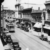
View of Pacific Avenue, looking north. On the right is the I.O.O.F. (International Order of Odd Fellows) Town Clock building. The streetcar is Union Traction No. 11.

Date: 1916
Type: PHOTO

http://history.santacruzpl.org/omeka/uploads/0000/0196.jpg
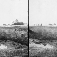
A stereograph of the first Santa Cruz Lighthouse on West Cliff Drive. It was built by the U.S. government in 1869 and torn down in 1948.

Date: Prior to 1886
Type: PHOTO

http://history.santacruzpl.org/omeka/uploads/0000/0172.jpg
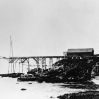
The wharf at Pigeon Point Landing. At one time, it was used as a whaling station and a shipping station for the dairy products from nearby coastal dairies. Pigeon Point was named for the British sailing vessel, the Carrier Pigeon, that wrecked on the…

Date: ca. 1870s
Type: PHOTO

http://history.santacruzpl.org/omeka/uploads/0000/0135.jpg
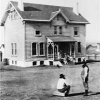
The lighthouse keeper's house at the Pigeon Point Lighthouse. (Later Pigeon Point Lighthouse State Historic Park).Pigeon Point was part of Santa Cruz County until 1868 when it became part of San Mateo County.

Date: Undated
Type: PHOTO

http://history.santacruzpl.org/omeka/uploads/0000/0031.jpg
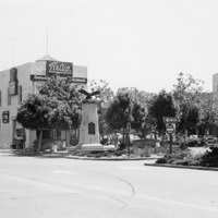
The intersection of Pacific Avenue and Front Street. Prominent in the scene is the Tea Cup Restaurant & Cocktails located in the building known as the Flatiron.

Date: 1977
Type: PHOTO

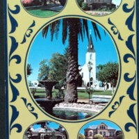
v3-095.jpg
Back not scanned.

Date: Undated
Type: POSTCARD

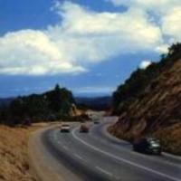
summit.jpg
The summit of the stretch of Highway 17 that passes through the Santa Cruz Mountains is called Patchen Pass. The elevation of Patchen Pass is 1,808 feet.

Date: Undated
Source: Santa Cruz County Place Names: a Geographical Dictionary. Donald Thomas Clark. Santa Cruz Historical Society, 1986. pgs. 246-252.

Type: ARTICLE

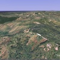
Highest.jpg
Mount Bielawski is the highest point in Santa Cruz County with an elevation of 3,231 feet. It is located on Castle Rock Ridge, and was named in 1861 after Captain Casimir Bielawski of the Surveyor General's Office.

It has also been called Mount…

Date: Undated
Source: Santa Cruz County Place Names: a Geographical Dictionary. Donald Thomas Clark. Santa Cruz Historical Society, 1986. p.221.

Type: ARTICLE

Output Formats

atom, dcmes-xml, json, omeka-json, omeka-xml, rss2