Browse Items(171 total)

  • Subject is exactly "Santa Cruz (City)"
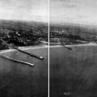
http://history.santacruzpl.org/omeka/uploads/misc/loc001.jpg
This aerial photograph of Santa Cruz was taken in 1906 by George Lawrence. His 50 lb. custom aerial camera was lifted approximately 800 feet by a string of 17 cargo kites.

Date: June, 1906
Type: PHOTO

AR-130.pdf

Date: 10-20-2000
Source: From: Fully Developed Context Statement for the City of Santa Cruz. Prepared for City of Santa Cruz Planning and Development Department. Prepared by Susan Lehmann, October 20, 2000. Chapter 5, Context III: Institutions in Santa Cruz County -- 1850-1950, pp. 45-47.
Type: ARTICLE

SantaCruz.jpg
* Latitude: 36.59 N
* Longitude: 122.02 W
* Area: 13.3 sq. miles
* Elevation: 20 ft. above sea level

Date: Undated
Source: Goode's World Atlas.
Skokie, IL. Rand McNally & Co., 2000.


Type: ARTICLE

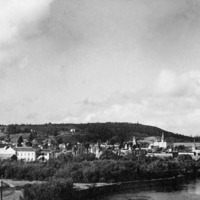
http://history.santacruzpl.org/omeka/uploads/0000/0036.jpg
A view of downtown Santa Cruz from the San Lorenzo River. Foreground spires visible: Presbyterian Church, Mission High School, Holy Cross convent. Foreground left is the railroad track to beach.

Date: Undated
Type: PHOTO

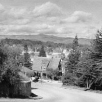
http://history.santacruzpl.org/omeka/uploads/0000/0049.jpg
A view from Santa Cruz High School. In the background is Loma Prieta peak, the highest peak in the Santa Cruz Mountains.

Date: Undated
Type: PHOTO

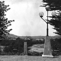
http://history.santacruzpl.org/omeka/uploads/0000/0058.jpg
A view of the San Lorenzo River and the city of Santa Cruz, taken from the Rennie House (demolished in 1970) on Beach Hill.

Date: Undated
Type: PHOTO

http://history.santacruzpl.org/omeka/uploads/0000/0332.jpg
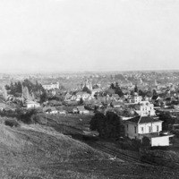
View of the city of Santa Cruz. Holy Cross Church is to the left.

Date: ca. 1900
Type: PHOTO

http://history.santacruzpl.org/omeka/uploads/0000/0333.jpg
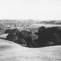
View of Santa Cruz from Pogonip(?). The spire of Holy Cross Church is visible in the background, on the right.

Date: Undated
Type: PHOTO

http://history.santacruzpl.org/omeka/uploads/0000/0335.jpg
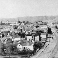
View of Santa Cruz, northward. (Is the street Pacific Avenue?)

Date: 1880's
Type: PHOTO

http://history.santacruzpl.org/omeka/uploads/0000/0336.jpg
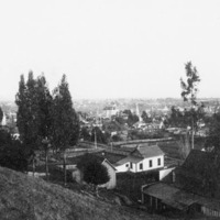
View of Santa Cruz from High Street. To the left is Holy Cross Roman Catholic Church on Mission Hill.

Date: Undated but after 1889 (when Holy Cross Church was completed)
Type: PHOTO

Output Formats

atom, dcmes-xml, json, omeka-json, omeka-xml, rss2