Browse Items(316 total)

  • Subject is exactly "San Lorenzo River"
http://history.santacruzpl.org/omeka/uploads/0000/0497.jpg
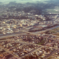
Aerial view of downtown Santa Cruz, the San Lorenzo River and surrounding area. The Soquel Avenue bridge is in the middle of the photo

Date: 1973
Type: PHOTO

http://history.santacruzpl.org/omeka/uploads/cov/cov-018.jpg
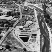
This aerial photograph of Salz Tannery was taken in the early 1950's possibly by Vester Dick Photography. River Street/Highway 9 is on the left and the San Lorenzo River is on the right.

Date: 1950's
Type: PHOTO

http://history.santacruzpl.org/omeka/uploads/wd/WD-004.jpg
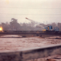
City workers using a crane on the Riverside Avenue bridge to try to loosen a log jam. The photo is taken during one of the storms of 1983 that caused the San Lorenzo River to flood.

Date: 1983-01-03
Type: PHOTO

http://history.santacruzpl.org/omeka/uploads/wd/WD-019.jpg
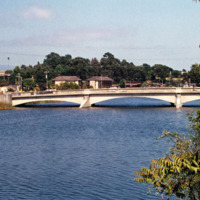
Riverside Avenue Bridge which crosses the San Lorenzo River. The view is looking east from Third Avenue.

Date: Undated
Type: PHOTO

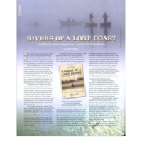
lostcoast.pdf

Date: 2010-Spring
Source: Santa CruzMagazine, v5n1, p36-37
Type: ARTICLE

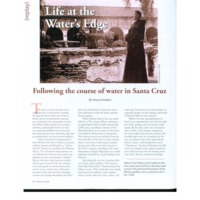
water.pdf

Date: 2015-Winter
Source: Santa Cruz Style, v4n4, p60-63
Type: ARTICLE

Plan to straighten river

Date: 1890-05-09
Source: Santa Cruz Daily Surf 1890-05-09: page 3 column 2
Type: NEWS

Date: 1893-01-20
Source: Santa Cruz Daily Surf 1893-01-20: page 8 column 1
Type: NEWS

Date: 1887-02-05
Source: Santa Cruz Daily Surf 1887-02-05: page 1 column 2
Type: NEWS

Date: 1889-09-06
Source: Santa Cruz Daily Surf 1889-09-06: page 3 column 2
Type: NEWS

Output Formats

atom, dcmes-xml, json, omeka-json, omeka-xml, rss2